Rebuilding Eden in the Land of Eridu

Posted in: Ancient Near East Today, ASOR
Tags:

By Marco Ramazzotti

The site of Eridu had a special place in the Mesopotamian tradition. In Babylonian literature the relevance of Eridu was always more religious than political. For example, in the Sumerian King List the gods first handed kingship down to Eridu. In Babylonian mythology Eridu was founded by the god Enki/Ea, who warned Zuisudra, the Sumerian Noah, about the flood. Moreover, the central core of the site of Eridu, whose name became later interchangeable with Babylon, was Enki/Ea’s temple, called the House of the Aquifer. But what about the archaeology of Eridu?

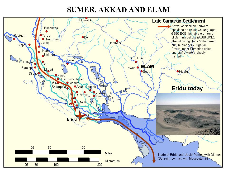
Map showing location of Eridu (Wikimedia Commons)

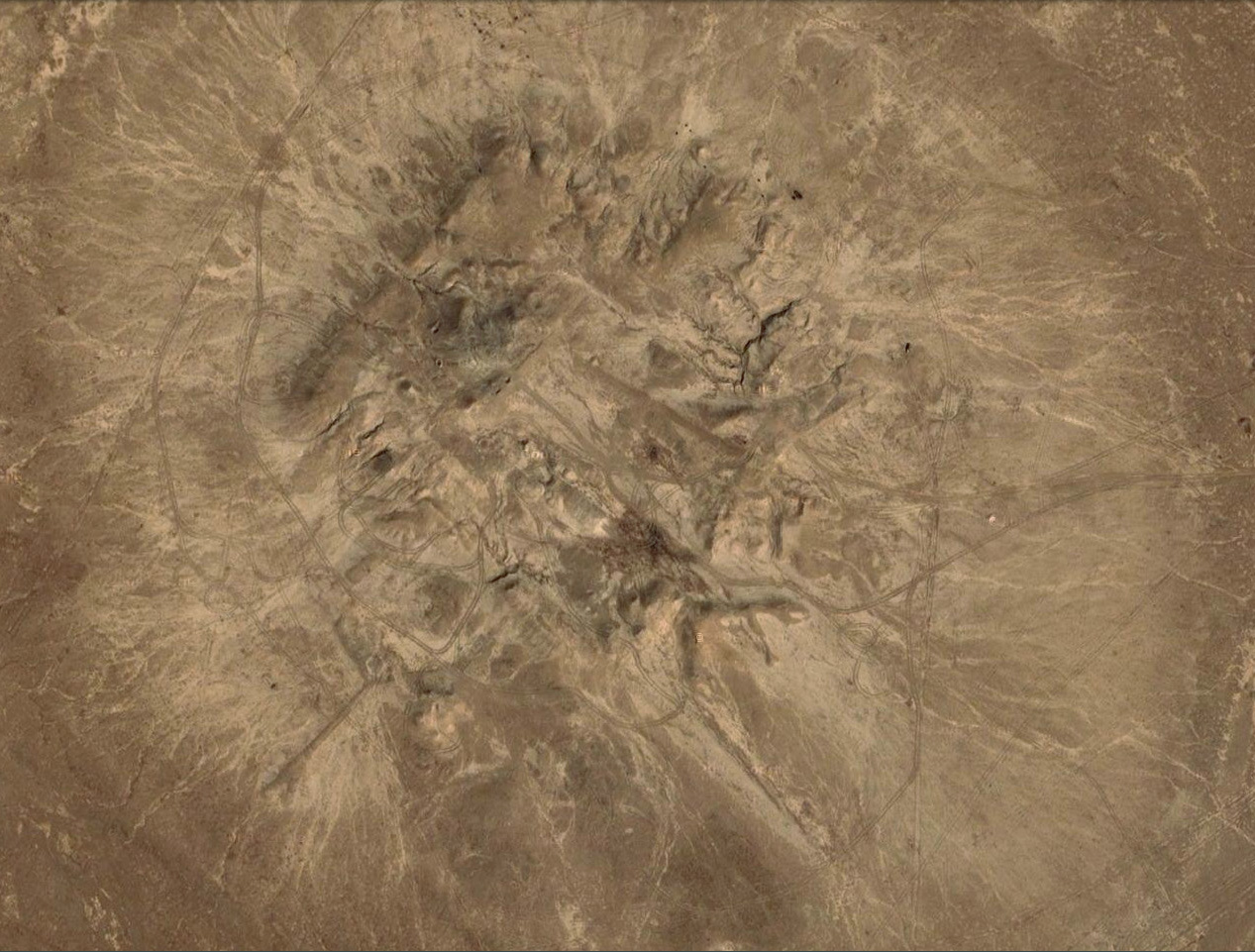
Satellite image of the mound 1 at Eridu (© Google Earth)

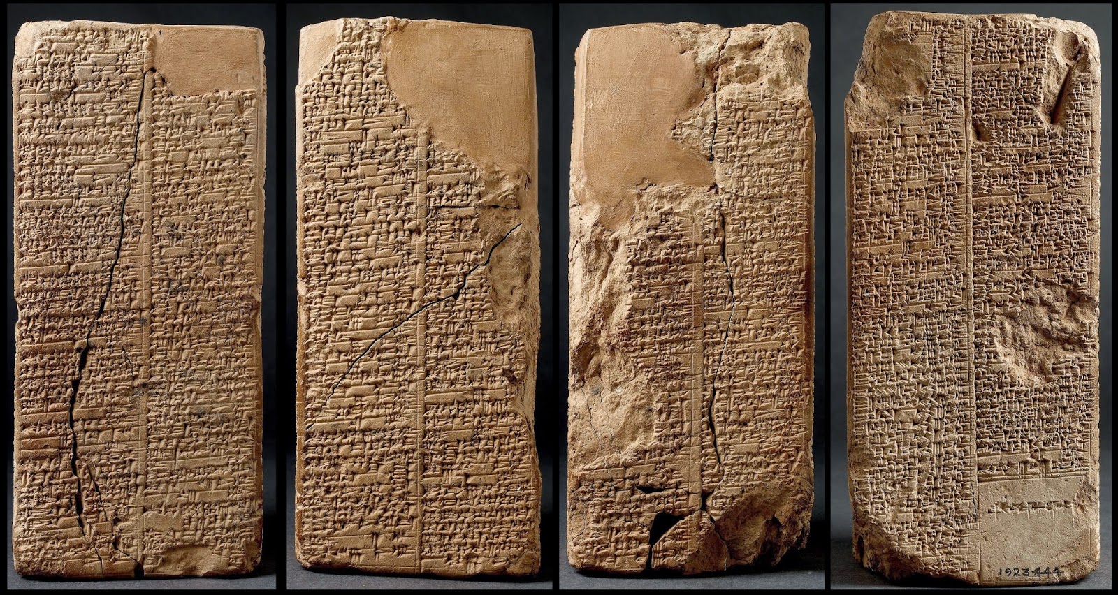
The Weld-Blundell prism, copy of the Sumerian King List (© Oxford, Ashmolean Museum)

The Enki Temple at Eridu: an hypothetical reconstruction (Rice 1984)

Eridu is situated about 12 kilometres south-southwest of Ur (Tell Muqayyar) and comprises seven mounds. Across more than 8,000 years settlement at Eridu shifted over more than 25 square kilometres. Though today it is located in the desert, in antiquity Eridu’s principal ecological asset was the southern Iraqi marshland, an ecology that has been dramatically altered since the 1970s.

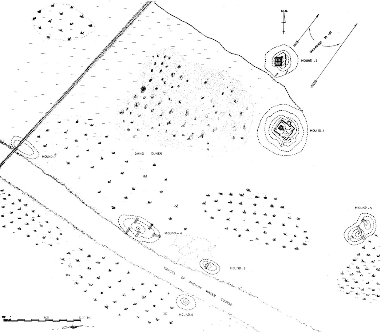
The first topography of the of the Eridu Landscape
(Safar et al. 1981)

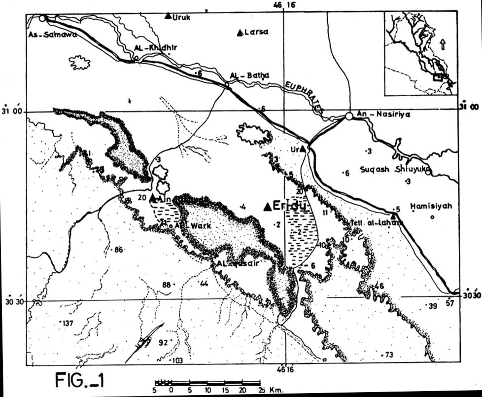
The geological setting of the of the Eridu Hinterland
(Safar et al. 1981)

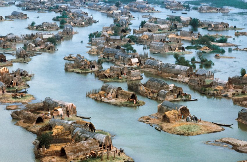
The Marsh-Arab southern Iraqi village in the Marshland (© Der Spiegel 1974)

The archaeological significance of Eridu is also related to the deep stratigraphy of its principal mound (Abu Shahrein), explored in the 1940s by pioneering archaeologists Fuad Safar and Seton Lloyd, which revealed the oldest southern Mesopotamian temple. It is also related to the fundamental pottery study by Joan Oates of the Eridu assemblages that created a guideline to understand the passage between the prehistory and history of the ancient Near East, including the Sumerians entry onto the historical stage.


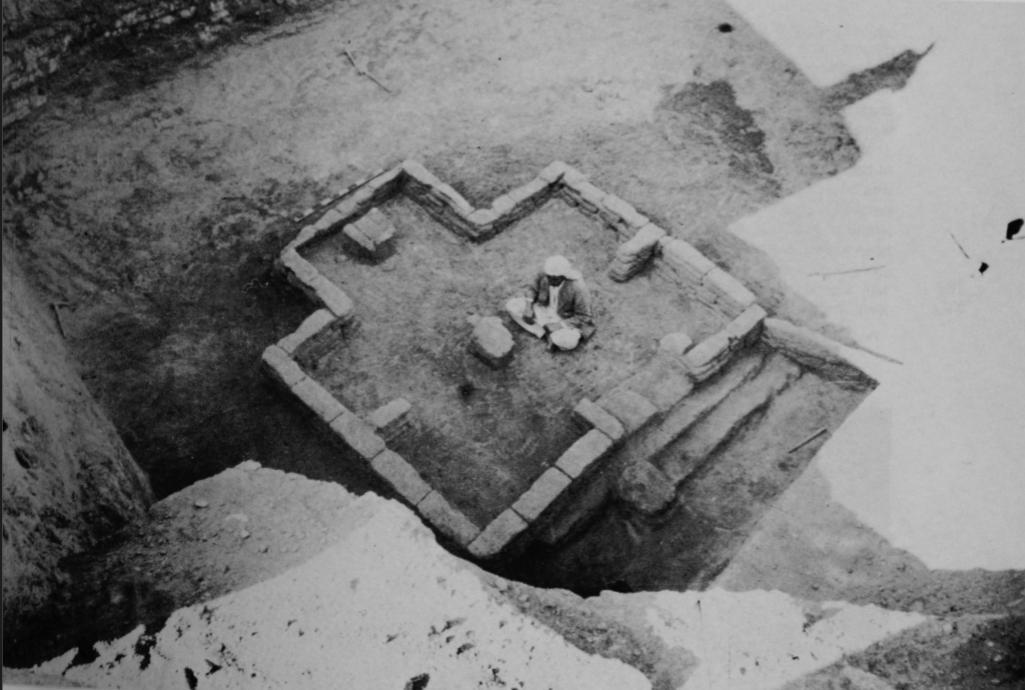
The Eridu first Temple, Level XVI (Safar et al. 1981)

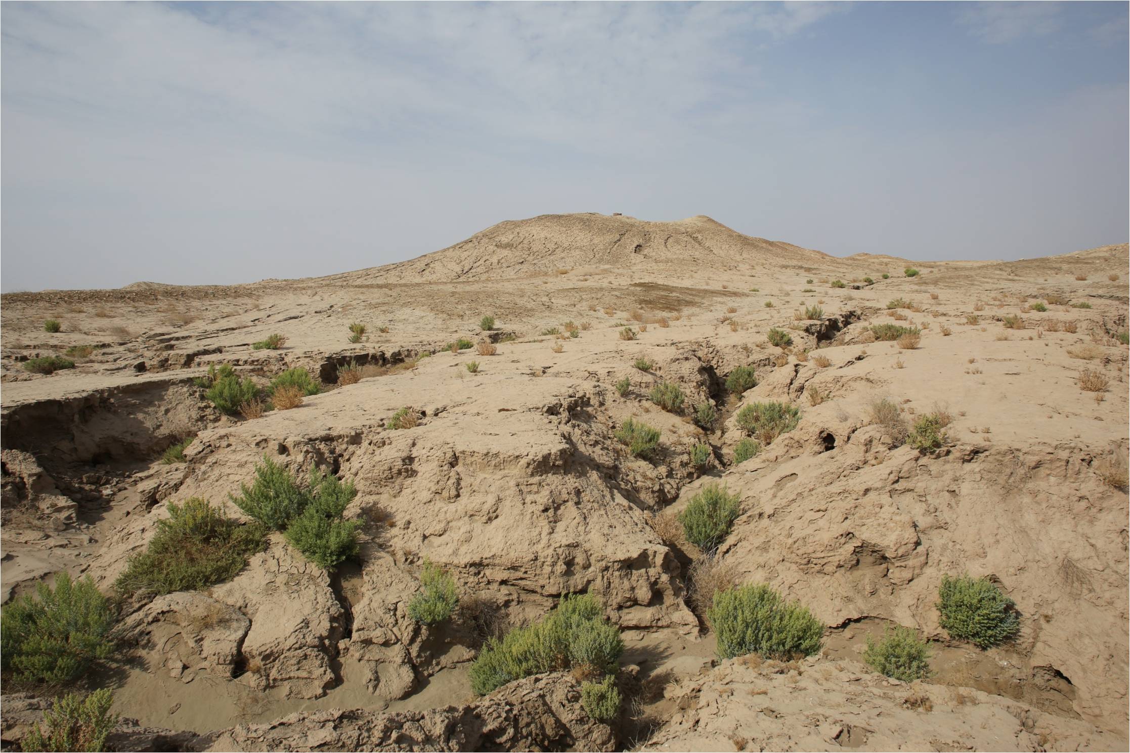
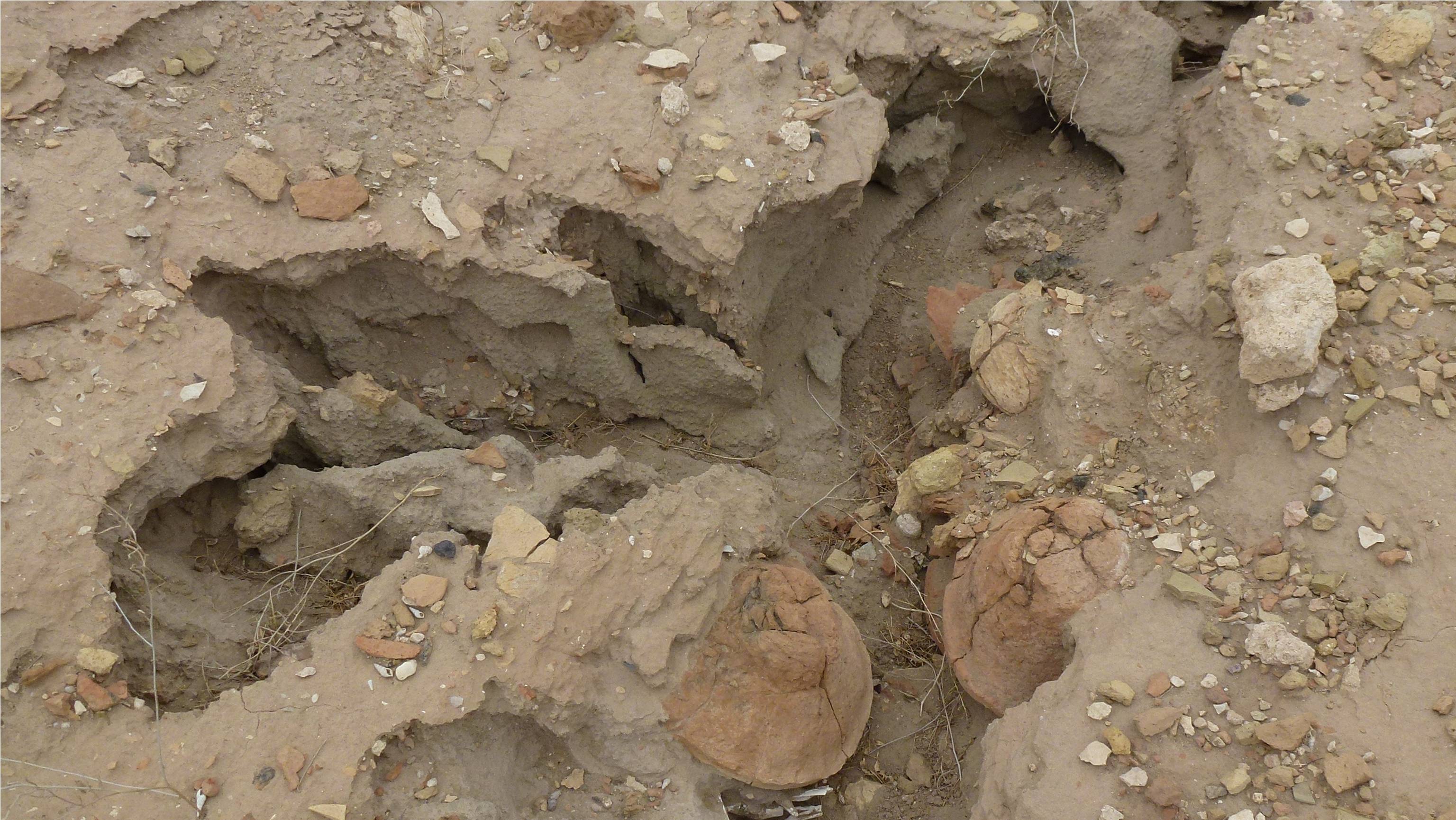
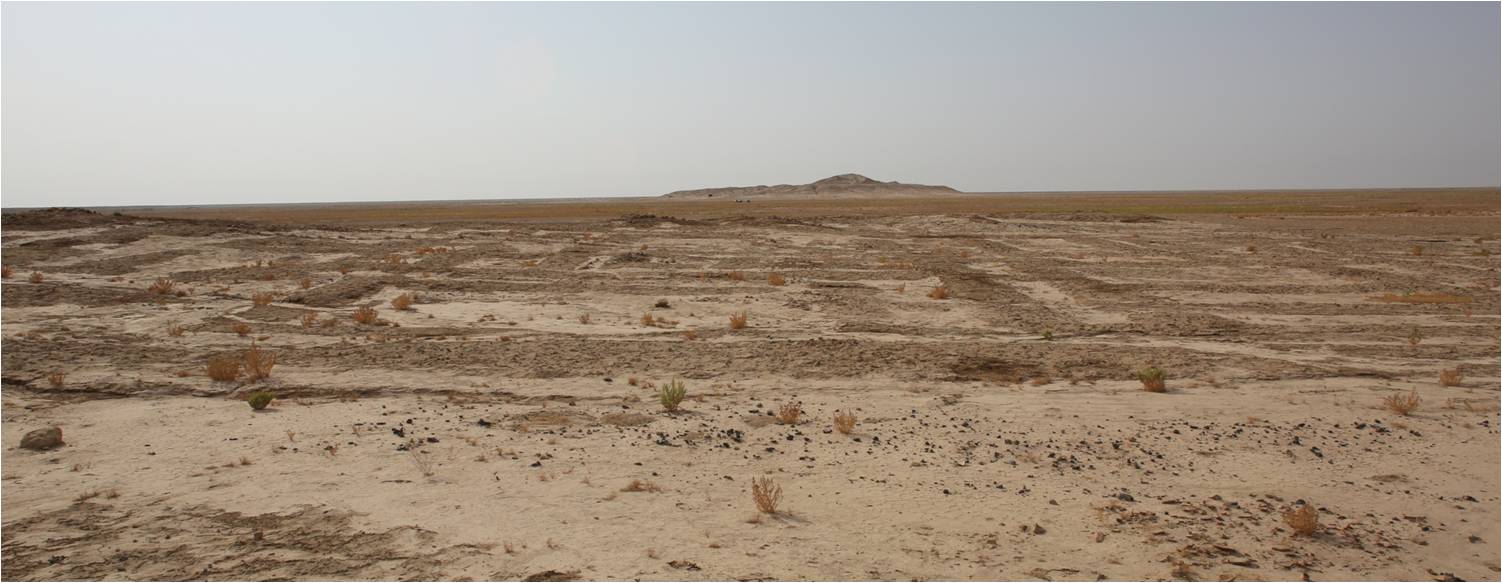
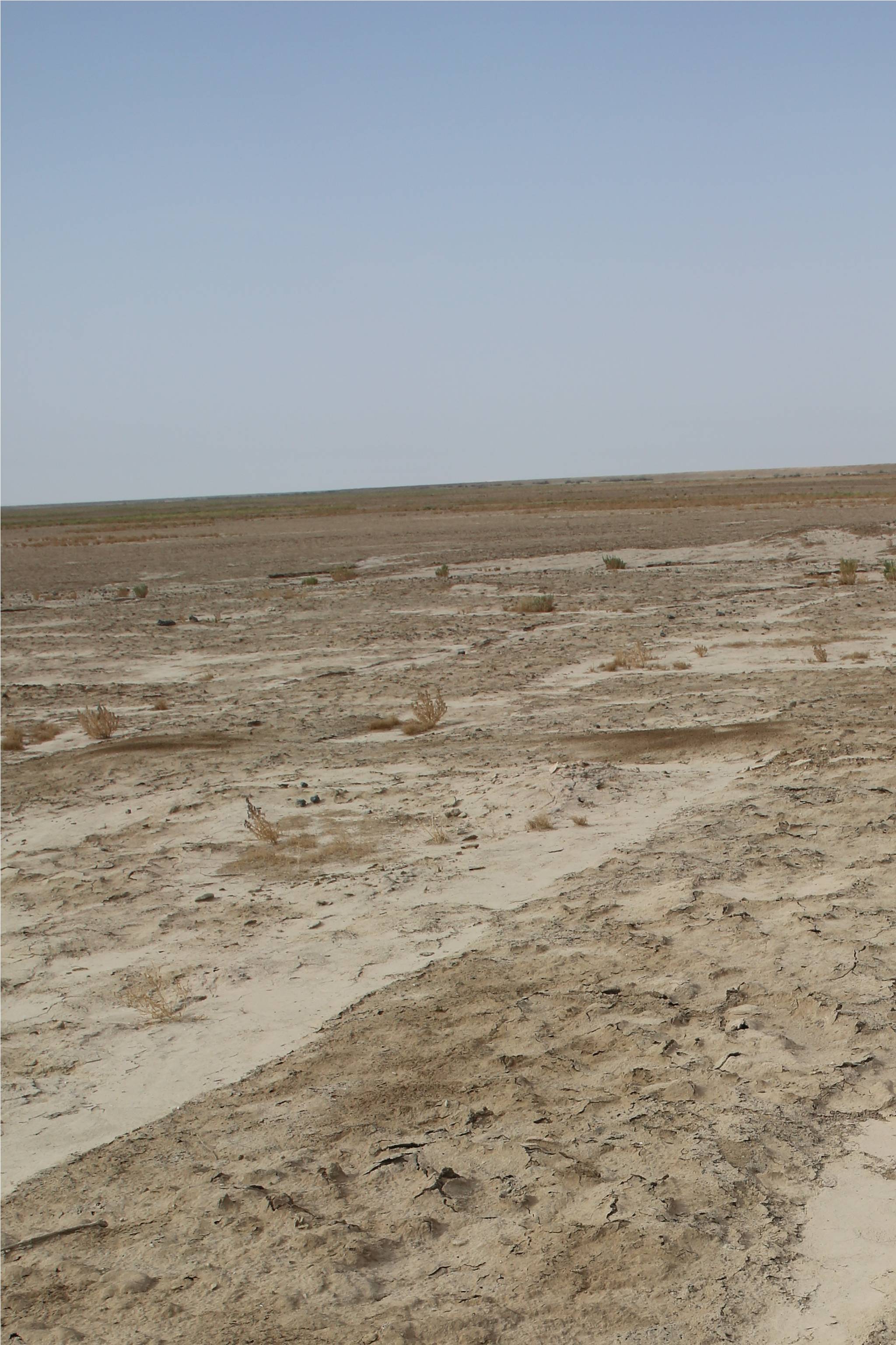
Mound 1 from south-east
(Photo by M. Ramazzotti)

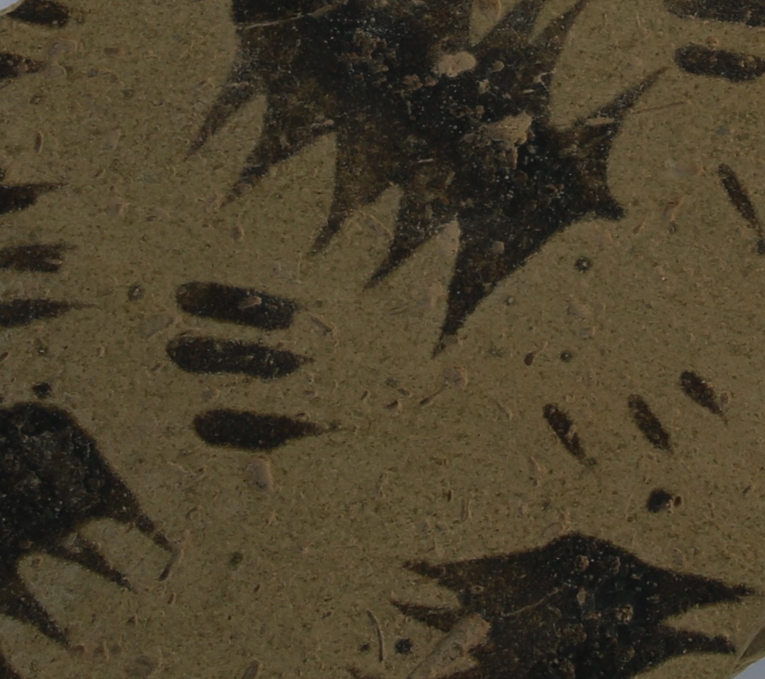
Ubaid painted motifs (Vth millennium BCE), pottery from the Mound 1 at Eridu (Photo by M. Ramazzotti)

Protohistoric bowls (IVth millennium BCE) on the Mound 1 surface at Eridu (Photo by M. Ramazzotti)

The image of Eridu as an isolated religious cathedral in the desert was also dramatically revised by the Oriental Institute of Chicago surveys in central-southern Mesopotamia, particularly the Ur and Eridu regional survey directed by Henry Wright. This undisputed guide to land use on the Central Floodplain of the Euphrates was changed again during the 1990s by different experimental studies on complex systems, and specifically those focusing on simulation of Mesopotamian settlement patterns using advanced computational methods.

Our project on the Eridu Hinterland focuses on both the cultural and symbolic functions of the Holy Sanctuary of Enki in the Abu Shahrein landscape through more than eight millennia. We assume that Eridu was not an urban center with a redistributive economy, as Uruk and Ur later were, but was instead the center of the Sumerian economic, religious and political identity.

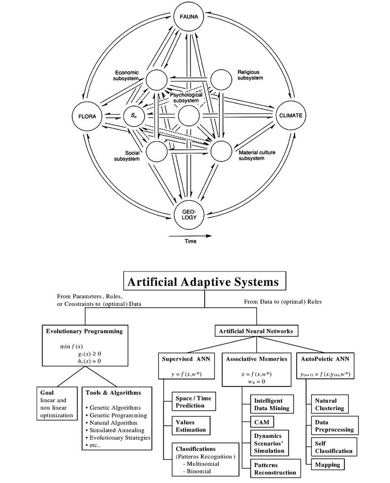
A Complex System according to D. L. Clarke and new algorithms for the Complex System modelling and simulation. M. Ramazzotti, Analytical Archaeology and Artificial Adaptive Systems, in M. Ramazzotti (ed.), Archeosema. Artificial Adaptive Systems for the Analysis of Complex Phenomena. Collected Papers in Honour of David Leonard Clarke (Archeologia e Calcolatori 6), Firenze: 14-52

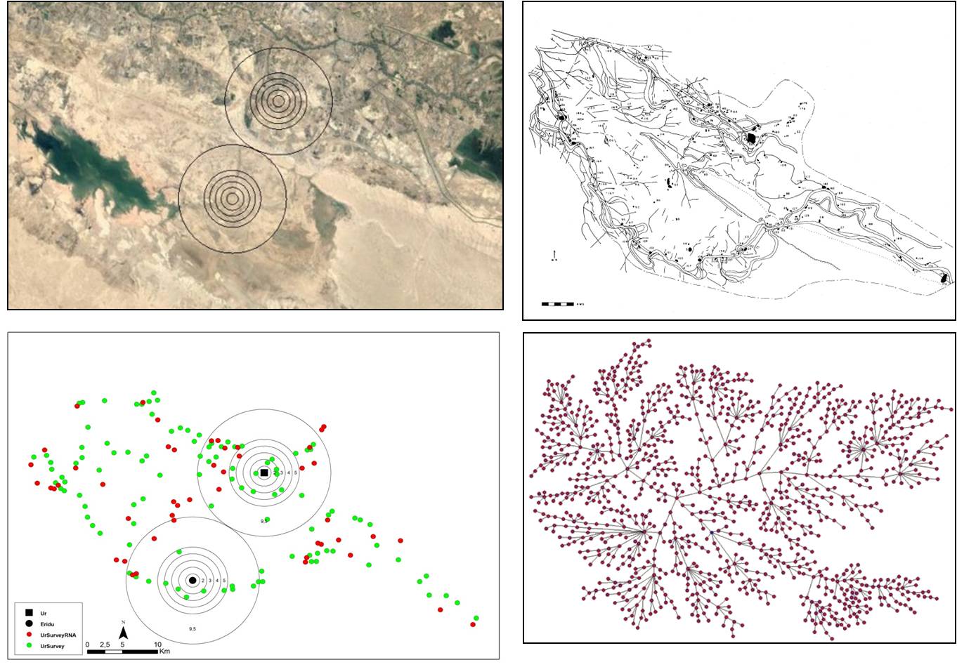
Geomatic and neural model of the Vth IVth and IIIrd millennium BCE settlement system in the region between Ur and Eridu. M. Ramazzotti, A Neural Spatial Analysis of the Ur & Eridu Sub-Regional Settlement System, San Antonio Texas, ASOR

Our project on the Eridu Hinterland focuses on both the cultural and symbolic functions of the Holy Sanctuary of Enki in the Abu Shahrein landscape through more than eight millennia. We assume that Eridu was not an urban center with a redistributive economy, as Uruk and Ur later were, but was instead the center of the Sumerian economic, religious and political identity.

Previous settlement research on the Eridu Hinterland showed that isolated settlements atop ‘turtlebacks’ or rock outcroppings were characteristic of the Ubaid period (ca. 5500-4000 BCE). By the Early Uruk period (ca. 4000-3500 BCE) settlements were dispersed throughout the alluvium, and could be mapped in linear patterns along what were presumed to be relict branches of the Tigris and Euphrates.

More and larger sites were visible as surface scatters, some approaching genuinely urban scale (20 hectares and above). Notable among these was Eridu, at 40 hectares but in the succeeding Late Uruk period (ca. 3500-3000 BCE), while Ur continued as a small town of 10 hectares, Eridu seems to be gradually abandoned, probably in connection with rapid desiccation of the surrounding plain. Only in the Early Dynastic II Period (ca. 2900-2350 BCE), when a Royal Palace was built on the top of Mound 2, Eridu becomes an important urban center.

The Early Dynastic palace on the top of the Mound 2 at Eridu (Photo by M. Ramazzotti)

The central sector of the Early Dynastic palace on the top of the Mound 2 at Eridu (Photo by M. Ramazzotti)

During the Third Dynasty of Ur (ca. 2112-2004 BCE), Abu Shahrein reached its greatest size, as attested by the eroded platform of the impressive, still-preserved ziggurat. Though it now only rises to a height of about 9 meters, it is clear that the base supported a much higher superstructure. Eridu was abandoned for long periods, until it was finally deserted and allowed to fall into ruins in the 6th century BCE. The encroachment of neighbouring sand dunes and the rise of a saline water table set early limits to its agricultural base so, in its later Neo‐Babylonian development, Eridu was probably rebuilt only as a temple site, in honor of its earliest history.

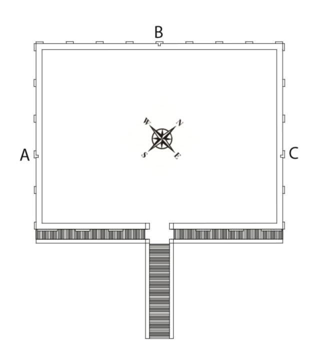
Hypothetical reconstruction of the plan of the Ziqqurat at Eridu (© Ramazzotti and Di Vittorio)

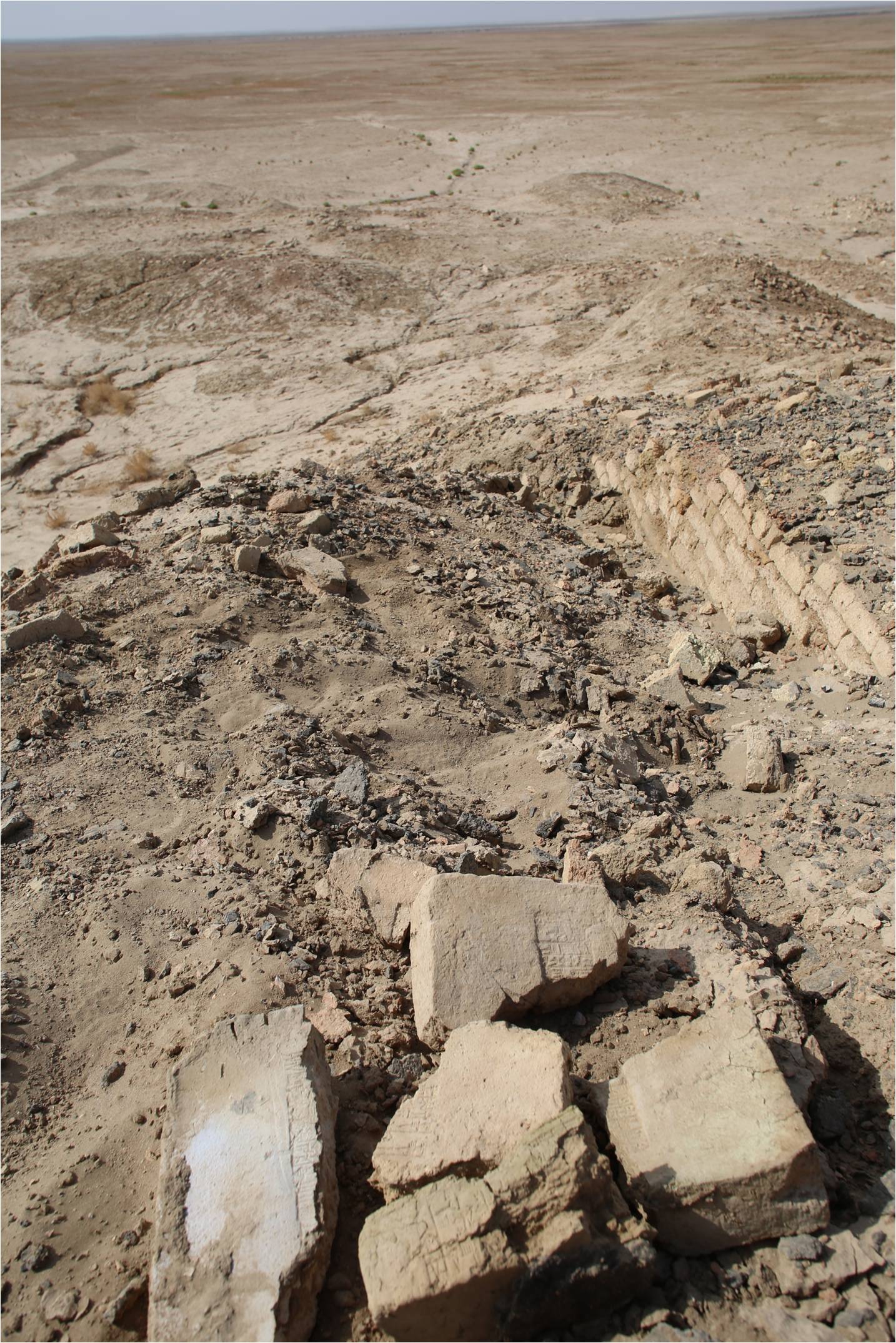
The western slope of the Ziqqurat from the top of Mound 1 at Eridu (Photo by M. Ramazzotti)

We propose that the landscape transformations of the Eridu Hinterland were the result of a confluence of political, social and economic factors. The first human adaption to a land between the desert, the alluvial plain, the marshlands, and the sea was not the result of an economically driven settlement process, but something more complex and adaptive. Our goal is to integrate classical and natural computing models, and models inspired by biological systems.

The Eridu Landscape Project’s agreement with the State Board of Antiquities & Heritage (SBAH) was signed in Augustand the first preliminary survey undertaken by the Iraqi-Italian archaeological mission in October. Our plans for the next season, if adequately financed, will start with an intensive archaeological, geological, and ethnographical survey of the entire settled area (25 km2) and surrounding landscape. The survey will continue for three years, when a detailed analysis of the natural and cultural assessment will be published. This will define the boundaries of a new protected natural and historical park: an Eden artificially rebuilt as the origin spot of the Mesopotamian past. 

* I am grateful to La Sapienza University of Rome who made my research on southern Mesopotamian urbanism possible, to Italian Ministry of Foreign Affairs and International Cooperation who sustained our preliminary field activities on the Land of Eridu and to the Iraqi State Board of Antiquities & Heritage (SBAH) for the permission for excavate at Eridu.

Marco Ramazzotti is Researcher and Aggregate Professor of Near Eastern Art and Archaeology at La Sapienza University of Rome, Faculty of Letters and Philosophy, Department of Classics.

For further reading

Adams 1981: R. McC. Adams, Heartland of Cities, Surveys of Ancient Settlement and Land Use on the Central Floodplain of the Euphrates, Chicago‐London.

Hritz et al.: C. Hritz - J. Pournelle - J. Smith, Revisiting the Sealands: Report of Preliminary Ground Reconnaissance in the Hammar District, Dhi Qar and Basra Governorates, Iraq 74: 37‐49.

Ramazzotti, M. Ramazzotti, The Iraqi-Italian Archaeological Mission at the Seven Mounds of Eridu, Scienze dell’Antichità, XXI/1: 3-29.

Ramazzotti, M. Ramazzotti, Back to the Future. Structuring an Analytical Model for the Mesopotamian Urbanism: a view from the South, in M. Iamoni (ed.), Trajectories of Complexity. Socio-economic Dynamics in Upper Mesopotamia in the Neolithic and Chalcolithic Periods (Studia Chaburensia 6), Wiesbaden: 183-194.

Safar, Mustafa, Lloyd 1981, F. Safar et al., Eridu. Ministry of Culture and Information, State Organization of Antiquities and Heritage, Baghdad 1981.

~~~

All content provided on this blog is for informational purposes only. The American Schools of Oriental Research (ASOR) makes no representations as to the accuracy or completeness of any information on this blog or found by following any link on this blog. ASOR will not be liable for any errors or omissions in this information. ASOR will not be liable for any losses, injuries, or damages from the display or use of this information. The opinions expressed by Bloggers and those providing comments are theirs alone, and do not reflect the opinions of ASOR or any employee thereof.

1 Comments for : Rebuilding Eden in the Land of Eridu
  1. Pingback: Rebuilding Eden in the Land of Eridu — The ASOR Blog | Talmidimblogging

Comments are closed.